The challenge
While great strides have been made in the development of the Soil and Landscape Grid of Australia and the Australian Soil Information System, Australia’s public and private soil data assets are not easily discoverable and accessible, or easily combined. This limits the quality and density of digital soil information that can be readily used across the public and private sector and the development of digital agriculture products and services (Barry et al., 2017)
The data
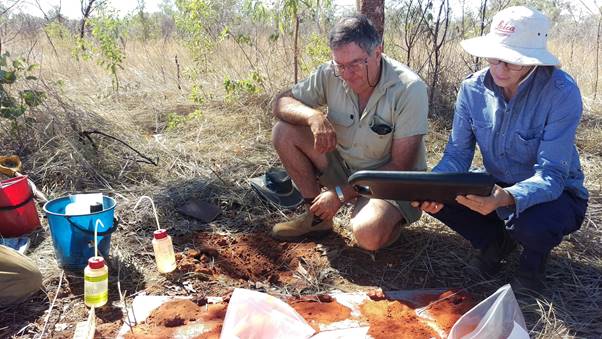
CSIRO are custodians of soil data resources including the Soil and Landscape Grid of Australia (SLGA) soil attribute maps and the National Soil Site Database (NatSoil) containing descriptions of approximately 16,000 soil site investigations from predominantly CSIRO led surveys.
The Centre for eResearch and Digital Innovation (CeRDI, Federation University) is a broker of soil data from both public and private collectors such as grower groups and Catchment Management Authorities.
The solution
CSIRO and CeRDI worked together to make their soil datasets, collections, and services more discoverable, accessible, interoperable, and reusable by making improvements to metadata and describing and delivering their data in a standard way that is understandable by both machines and humans. The teams worked together to:
- Develop soil-controlled vocabularies in CSIRO's Linked Data Registry . That is, machine readable (RDF) representations of terms used widely across the soil research domain in Australia. These were used to describe the soil datasets in a consistent and persistent way.
- Continue their work making data accessible using standard exchange protocols (OGC complex feature, coverage and map services and using SoilML and observations and measurements O&M design patterns)
- Improve the discovery of their soil datasets with service metadata records discoverable through Research Data Australia
Research and development applications
More accurate fine-scale data products
Partners have begun delivering and describing both public and private soil data in a common language. Continuing to make soil data discoverable, available, and reusable in this way will continually improve the quality of finer-scale soil products, such as the Soil and Landscape Grid of Australia.
On-farm tooling
For CeRDI, the on-farm soil benchmarking tools that they develop for public and private landholders will be more accurate for the end user.
This technology is being applied to the Soil CRC’s Visualising Australasia’s Soils project, allowing public and private data holders to contribute well described data for in-paddock tooling, and for CRC research should they wish.
Promoting cross-sectoral collaboration
Using common language to describe and exchange data opens opportunities to combine and reuse data across sectors for novel insights.
For example, the soil vocabularies being used by AgReFed partners are now being adopted in the environment sector (TERN soil landscapes).
Linda Gregory, Spatial Data Analyst, CSIRO, on her experience of making soil data more FAIR:
“The FAIR data process is very much a journey. You go through the process and come out with some improved attitudes or ideas of what is possible”
Dr Megan Wong, Research Associate, CeRDI:
“This has begun conversations in the soil community of how to create, use and govern soil vocabularies that we can all apply to make our data more reusable by others”
![]()

Barry, S. et al. (2017). Precision to Decision - Current and Future State of Agricultural Data for Digital Agriculture in Australia.